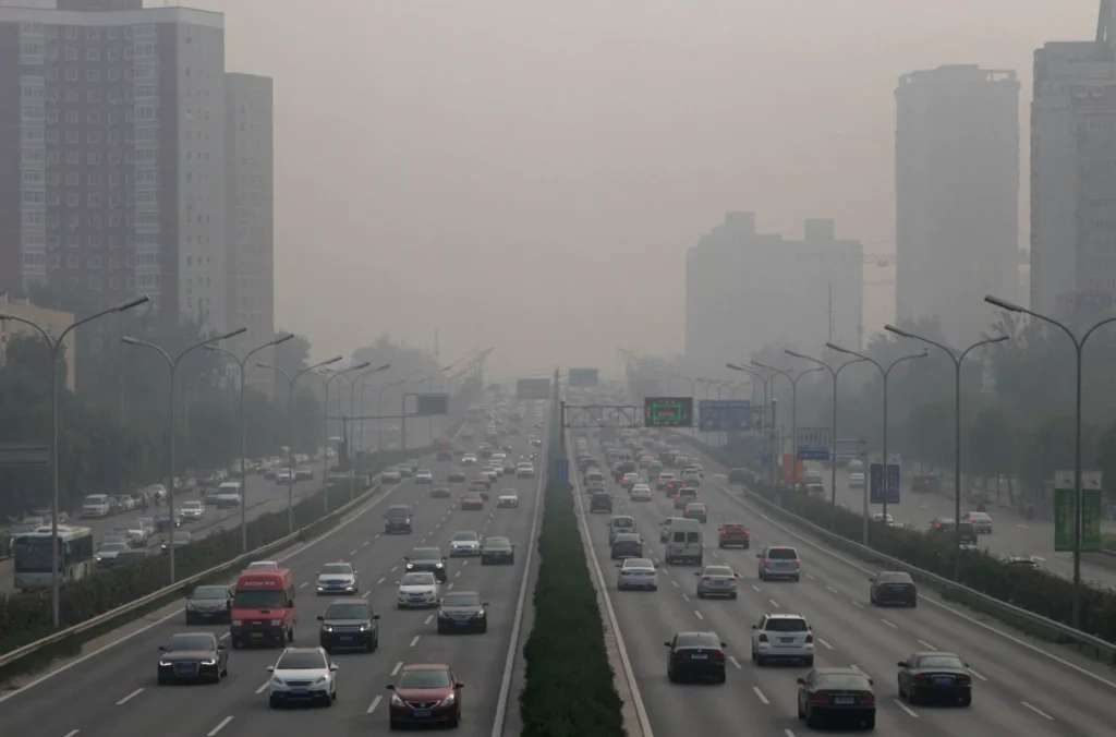
In the fields of meteorological monitoring and smart transportation, visibility is directly linked to operational safety. Whether it’s fog warnings on highways or safety management in port waterways, accurately measuring the Meteorological Optical Range (MOR) is essential. So, how exactly do modern devices replace the human eye to achieve precise measurements in extreme weather conditions? Today, let’s discuss how visibility is measured in the fields of meteorological monitoring and smart transportation.
How does visibility affect weather?
Visibility is a critical indicator of atmospheric conditions, reflecting the presence of fog, haze, precipitation, and airborne particles. While it does not directly affect weather, reduced visibility signals changes in the atmosphere and can indicate adverse conditions. Factors such as water droplets, snow, rain, dust, and pollution scatter or absorb light, lowering visibility and affecting transportation safety, aviation, and maritime operations. Long-term visibility trends also provide insights into air quality and environmental monitoring, making it an essential parameter for both meteorological analysis and practical decision-making.
Fog, Mist, and Haze: Key Differences in Atmospheric Visibility
Fog, mist, and haze are common atmospheric phenomena that reduce visibility, but they differ in particle composition, density, and formation conditions.
Fog: Fog is a dense collection of tiny water droplets suspended near the ground, typically reducing visibility to less than 1 km. It forms when air temperature cools to the dew point under high humidity, creating thick, localized obscuration.
Mist: Mist consists of smaller concentrations of water droplets than fog, usually allowing visibility between 1 km and 2 km. It occurs under similar humid conditions but is less dense, often appearing during early morning or after light precipitation.
Haze: Haze is caused by fine solid particles, such as dust, smoke, or pollution, suspended in the air. Unlike fog or mist, haze does not involve water condensation and generally reduces visibility over longer distances, giving the sky a blurred or pale appearance.
How does weather affect atmospheric visibility?
Atmospheric visibility is strongly influenced by weather conditions, as changes in the environment can either enhance or reduce the distance at which objects can be seen. Weather affects visibility by altering the composition and behavior of particles and moisture in the air, which scatter or absorb light, directly impacting how far and how clearly we can see.
The following is key Factors Affecting Visibility:
- Particle Concentration: Higher levels of dust, smoke, pollen, or pollution increase light scattering and reduce visibility.
- Humidity: High humidity promotes fog or mist formation, which significantly lowers visibility.
- Temperature: Temperature variations can create thermal gradients that affect the dispersion of particles and moisture.
- Wind Speed: Strong winds can disperse particles, temporarily improving visibility, or stir up dust and debris, reducing it.
- Precipitation: Rain, snow, or sleet obstruct light transmission, causing short-term visibility reduction.
How to measure weather visibility?
Measuring weather visibility typically involves two approaches: manual observation and instrument-based detection. Manual methods rely on human judgment to estimate the distance at which objects can be clearly seen, which often leads to inconsistencies due to individual differences and environmental interference. In contrast, modern visibility monitoring instruments use optical and sensor-based technologies to provide more accurate, continuous, and objective data. As a result, device-based measurement has become the preferred solution in meteorological monitoring, transportation safety, and environmental analysis.
1. Manual Observation Method
Manual observation typically involves selecting objects at known distances (such as buildings, mountains, or landmarks). Observers then estimate the current visibility distance by visually assessing how clearly these objects can be seen. For example, at a weather station, reference points at various distances are pre-established, and observers periodically record the distance to the “farthest identifiable object.” This method is simple to operate and relatively low-cost, but it is susceptible to factors such as observer experience, variations in visual acuity, and changes in lighting and weather conditions, resulting in poor data stability.
2. Instrument-Based Measurement Method
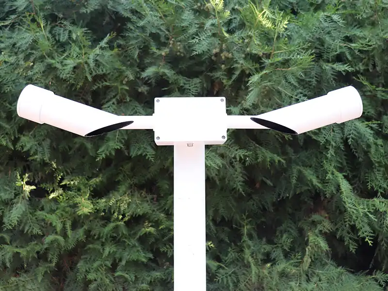
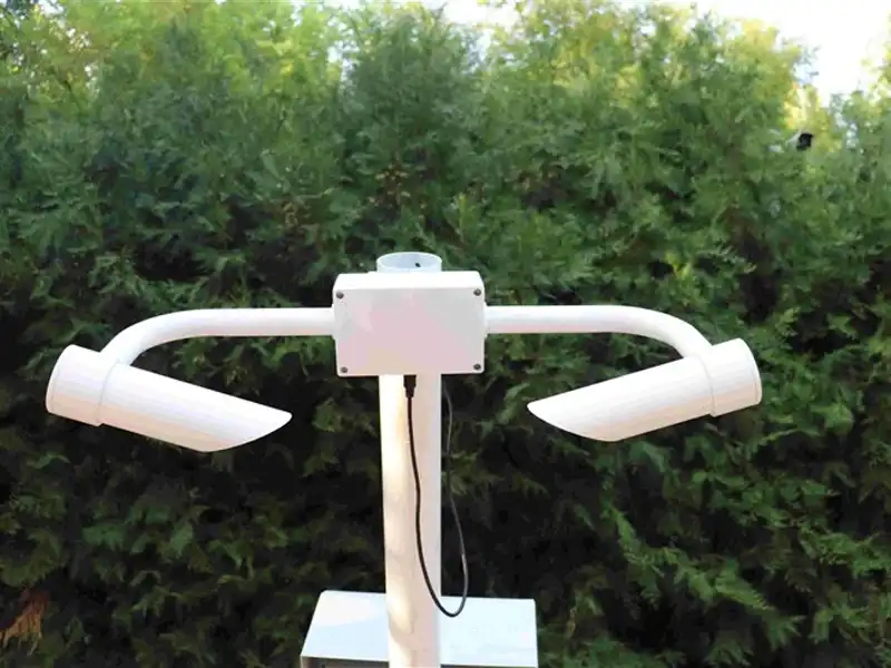
Instrument-based measurement methods primarily rely on specialized visibility sensors to achieve automated monitoring. Common principles include forward scattering and transmission methods: the sensor emits a light source (typically infrared or laser), detects the degree of light scattering or attenuation caused by airborne particles, and uses algorithms to calculate the meteorological optical range (MOR). This method enables continuous, all-weather monitoring, providing more objective and accurate data, and is widely used in scenarios such as airports, highways, ports, and environmental monitoring.
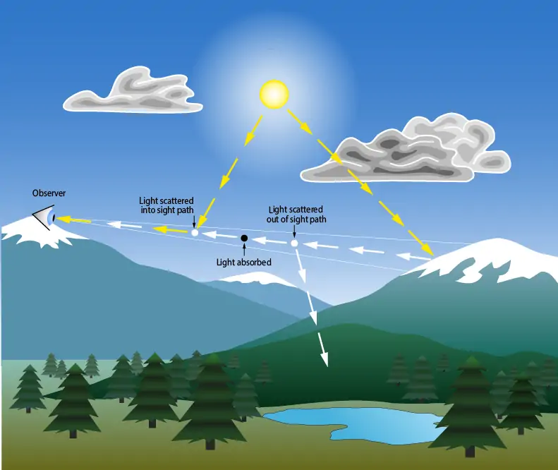
How does a visibility sensor work?
A visibility sensor determines atmospheric visibility by analyzing how airborne particles affect the transmission or scattering of light.
- Light Emission
The sensor emits a stable light beam, typically using an LED or laser source, into the surrounding air. - Interaction with Particles
Suspended particles such as fog, dust, smoke, or haze scatter and absorb the emitted light. - Signal Detection
A photodetector captures the intensity of scattered light (forward scatter method) or the reduction in transmitted light (transmissometer method). - Data Processing
The system converts the detected optical signal into electrical data and applies algorithms to calculate the atmospheric extinction coefficient. - Visibility Calculation
Based on standardized models (e.g., Koschmieder’s law), the sensor outputs the Meteorological Optical Range (MOR), representing the current visibility distance.
Yantai Case Studies and Technical Specifications
To give you a clearer understanding of the performance of our intelligent visibility sensors, here is a typical case study of our smart highway monitoring system:
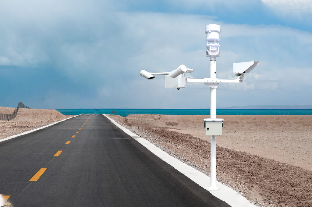
Technical Specifications
- Measuring Range: 10 m – 10,000 m (optional extensions up to 30 km/50 km).
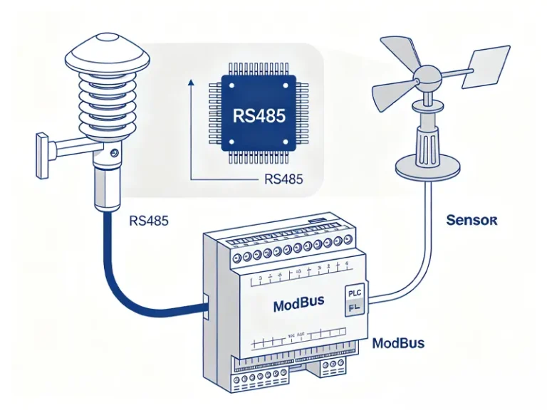
- Data Output: RS485 / Modbus-RTU.
- Light Source Stability: ±2% (ensuring long-term monitoring accuracy).
- Durability: IP66 protection rating, corrosion-resistant aluminum alloy housing, supports environments from -40°C to +60°C.
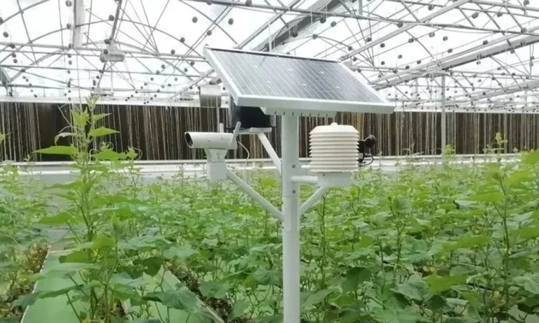
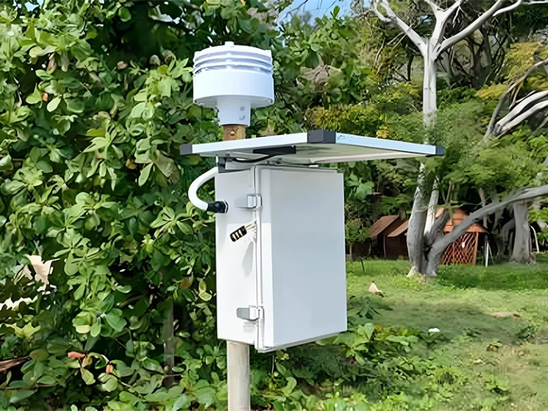
- Power Supply: Low-power design, perfectly suited for solar-powered weather monitoring.
Case Study: Smart Highway Fog Warning System
Background: On highways in mountainous areas or near bodies of water, visibility can often drop suddenly from 1 km to 50 m within minutes (i.e., “bank fog”).
Solution: Deploy XF-CQ10 visibility sensor in conjunction with a solar power system at intervals of 3–5 kilometers.
Scenario Data: When the sensor detects that visibility drops below 200 meters, the system automatically triggers a Modbus signal.
Interactive Feedback: The intelligent backend instantly activates flashing fog lights within a 2-kilometer radius downstream to issue a warning and pushes a “Slow Down Due to Heavy Fog” message to electronic information boards.
Results: Compared to manual patrols, response time has been reduced by over 95%, significantly lowering the risk of rear-end collisions caused by dense fog.
Key Considerations for Selection and Maintenance
In practical deployment, in addition to price, pay close attention to these three points:
Installation Height: It is recommended to install the device at a height of 1.5–2 meters to avoid the impact of ground dust on the sampling volume.
Calibration Interval: We recommend performing on-site verification using a standard calibration kit once every quarter to ensure the optical path has not been compromised by long-term environmental erosion.
Contamination Resistance: Select models equipped with lens contamination compensation, which can significantly extend the interval between manual maintenance.
FAQ
What is visibility measurement and why is it important?
Visibility measurement determines how far objects can be seen through the atmosphere, reflecting weather conditions such as fog, haze, rain, or snow. Accurate visibility data is critical for meteorology, aviation, road safety, and environmental monitoring. Modern sensors provide precise, real-time measurements that help industries and authorities make informed operational and safety decisions.
What are the main methods for measuring visibility?
Visibility can be measured manually or with instruments. Manual observation involves estimating distances to known objects but can be subjective. Instrument-based methods, using visibility sensors like forward scatter devices or transmissometers, provide continuous, accurate, and objective readings. Automated systems are preferred in airports, highways, and meteorological stations for reliable and standardized visibility monitoring.
How does a visibility sensor work?
A visibility sensor emits a light beam, usually infrared or laser, into the atmosphere and measures how particles like fog, dust, or smoke scatter or absorb light. Photodetectors capture these changes, and the system calculates the Meteorological Optical Range (MOR). Advanced algorithms convert optical signals into precise visibility distances for real-time monitoring.
What factors affect visibility readings?
Visibility readings are influenced by particle concentration, humidity, temperature, wind, and precipitation. High humidity and fog reduce visibility by condensing water droplets, while dust, smoke, or haze scatter light. Strong winds can disperse particles, temporarily improving visibility. Sensors account for these factors to provide accurate, reliable measurements across diverse weather and environmental conditions.
Where are visibility sensors commonly used?
Visibility sensors are widely applied in airports, highways, seaports, and environmental monitoring stations. They ensure safe navigation and transport operations under low-visibility conditions. Industrial sites and meteorological observatories also rely on these sensors for real-time weather monitoring, air quality assessment, and data collection to support research, forecasting, and public safety initiatives.
What types of visibility sensors are available?
The main types of visibility sensors include forward scatter sensors, transmissometers, and combined optical devices. Forward scatter sensors detect light scattered by particles at a fixed angle, while transmissometers measure the reduction of light over a fixed distance.
How to choose the right visibility sensor for my location?
Selecting a visibility sensor depends on application, environment, and required accuracy. Consider factors like measurement range, operating temperature, humidity resistance, and maintenance needs. Coastal or high-pollution areas require corrosion-resistant sensors, while airports need high-precision devices with fast response times. Consulting with professional manufacturers ensures sensors meet local climate, regulatory, and operational requirements.
Why Choose YanTai Sensor?
As a professional weather sensor manufacturer in China, YanTai Sensor delivers products that have passed rigorous testing in accordance with CE, ISO, and CNAS-certified laboratory standards. Our sensors are engineered to perform reliably in extreme environments, including resistance to salt spray corrosion and durability under repeated high and low temperature freeze–thaw cycles. This ensures consistent accuracy, stable performance, and trustworthy data output even in the harshest conditions.
Contact our team today to get customized solutions and expert support for your environmental monitoring needs.